Destination: The Great Sand Dunes National Park and Preserve in Mosca, Colorado in Alamosa County.
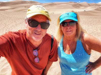
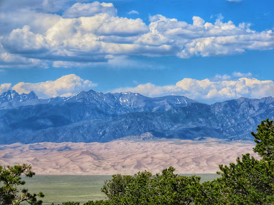
In the middle of nowhere are North America’s tallest sand dunes. In the picture at the top the dunes don’t look so big. But (right) when you’re on them, the dunes are daunting!
These sand dunes in Southern Colorado dwarf the ones in Kill Devil Hills, N.C. Where the Wright Brothers tested something called an airplane in 1903.
The dunes there are 100 feet high. The dunes here crest at 750 feet. The Sangre De Cristo Mountains are in the background. The range’s highest elevation is 14,351 feet. These mountains are part of the great Rocky Mountains.
Alesia did a great job mapping out this adventurous trip. After two nights in Colorado Springs (see my Fort Carson, Garden of the Gods and Rock Ledge Ranch Historic Site posts). we drove 160 miles to this out-of-the-way National Park. The remote route made for an interesting and scenic drive that I will document in a later post.
We had a surprise upon entering this “wilderness.”
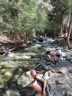
You must walk through water before you climb the sand dunes. Seasonally the water can be so high you have to wade or swim through it.
On this day, we just had to take off our shoes…
…and put them right back on because the sand is very hot…steep too!
We did not try to reach the top as these folks did. We climbed as far as we could. It is draining. The altitude is 7,000 feet plus even at the base of the dunes.
I enjoyed the photo opportunities presented by the contrasts of this unusual geography and ecosystem.
So how did this massive pile of sand come to be? I have read the how, why, and when but do not feel I can put it in layman’s terms so I’ll use what is says on the map and guide we picked up at the welcome center.
Under the headline “Stone, Sand and Stream” is the following: “Nestled against the rugged Sangre de Cristo Mountains the Great Sand Dunes are the focal point of a wild natural system of high mountain peaks, sparkling streams, forceful winds, and billions of sand grains.”
“Wind and water move sand, continually forming dunes. Most sand comes from the San Juan Mountains, over 65 miles to the west. Larger, rougher grains and pebbles come from the Sangre de Cristo Mountains. Sand and sediments from both washed into a huge lake once covering the valley floor.”
“As the lake reduced, southwesterly prevailing winds bounced the sand grains to be piled up beneath the Sangre de Cristo Mountains or washed back toward the valley floor.
Northeasterly winds blast through mountain passes, piling dunes back on themselves and creating…
…North America’s tallest dunes. The dunes are probably less than 440,000 years old.”
How much less? Just kidding.
That was quite a science lesson, wasn’t it?
By the 1920s the sand dunes had become a popular tourist destination. In 1932 national monument status was awarded. The Great Sand Dunes became a national park in 2004, not that long ago.
Many of the life zones can be seen in this image. Alpine Tundra is a treeless territory above 11,000 feet. Subalpine forest is in the elevation range of 9,500 to 11,000 feet. Montane Forest is the next lower elevation beginning at around 8,000 feet. Then there’s Dunefield, the dunes themselves. You wouldn’t think any plant or animal could live in the sand or even want to but there are, for example, seven insect species that thrive including the Great Sand Dunes Tiger Beatle.
After conquering the sand dunes (OK not really) we explored other parts of the vast park. There are displays to help with the context and big picture of this big place.
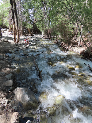
We decided to check out a waterfall that is part of the national park. The Zapata Falls is about three miles from the sand dunes on federal Bureau of Land Management property. We parked in the designated lot then did the lengthy walk (about half a mile but seems longer) up the Sangre de Cristo Mountains to the waterfall.
This visit was a neat experience. I had never heard of the Great Sand Dunes National Park and Preserve.


No comments:
Post a Comment